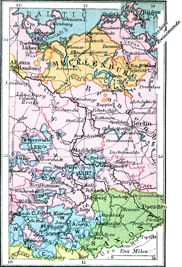
Description: The central region of North Germany around Mecklenburg on the Baltic Sea and Saxony. The map shows cities, ports, railroads, rivers, and the smaller German States north of the Thuringian Forest.
Place Names: Germany, Lubeck, �Mecklenburg, �Brandenberg, �Berlin, �Saxony, �Kiel, �Hamburg, �Leipzig, �Dresde
ISO Topic Categories: boundaries,
inlandWaters,
location,
oceans,
transportation
Keywords: Central Northern Germany, physical, �political, �transportation, physical features, country borders,
major political subdivisions, railroads, boundaries,
inlandWaters,
location,
oceans,
transportation, Unknown, 1920
Source: , Asprey's Atlas of the World (London, England: Asprey and Co., Ltd., 1920) 65
Map Credit: Courtesy the private collection of Roy Winkelman |
|