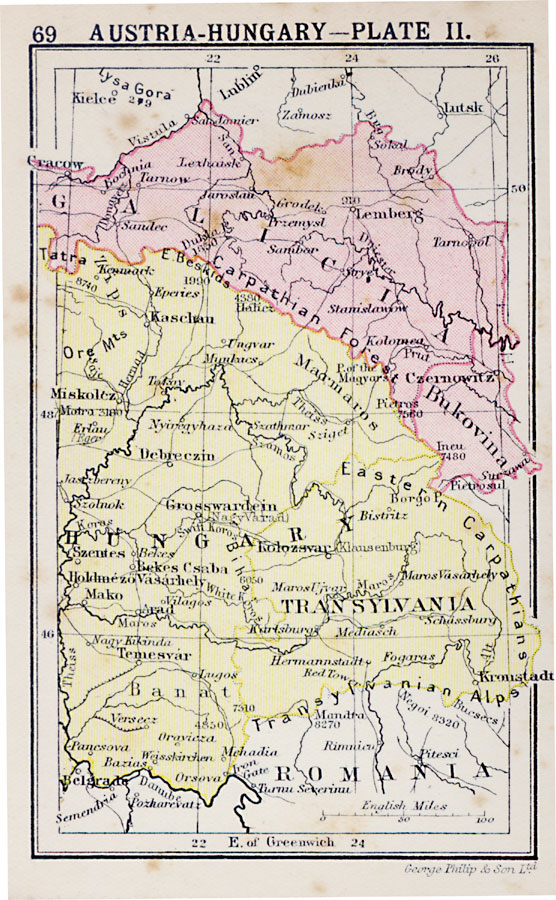
Description: Second in a series of regional maps of Austria–Hungary in 1920 showing the Austrian territory of Galicia and the eastern portion of Hungary (east of the Theiss or Tisza River), including Transylvania. The map shows major cities and towns, railroads, rivers, and mountain systems.
Place Names: Austria-Hungary, Galicia, �Bukovina, �Kaschan, �Cracow, �Miskolcz, �Transylvania, �Hungary, �Bana
ISO Topic Categories: boundaries,
inlandWaters,
location,
transportation
Keywords: Austria-Hungary, physical, �political, �transportation, physical features, country borders,
major political subdivisions, railroads, boundaries,
inlandWaters,
location,
transportation, Unknown, 1920
Source: , Asprey's Atlas of the World (London, England: Asprey and Co., Ltd., 1920) 69
Map Credit: Courtesy the private collection of Roy Winkelman |
|