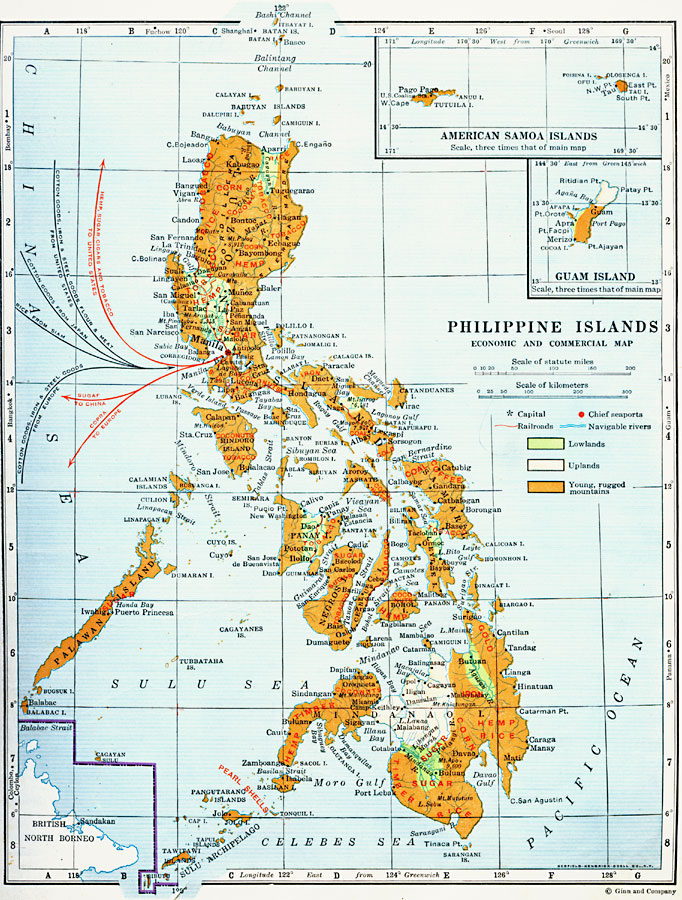
Description: A map from 1920 of the Philippine Islands showing the principal commercial products in the region, with the products named in red. The map shows major cities and chief seaports, railroads, navigable rivers, islands and coastal features. The map is color–coded to show lowlands, uplands, and the young, rugged mountain systems. Exports from Manila are shown in red arrows, with the destination given, and imports are shown in blue arrows, with the points of origin given. Two inset maps detail the United States possessions of the American Samoa Islands and Guam Island.
Place Names: Philippines, San Fernanado, �Manila, �Puerto Princesa, �Cagayan De Oro, �Baguio, �Batangas, �Legasp
ISO Topic Categories: economy,
location,
oceans,
inlandWaters
Keywords: Economic and Commercial Activity in the Philippine Islands, physical, �transportation, kEconomic, physical features, water routes, economy,
location,
oceans,
inlandWaters, Unknown, 1920
Source: Wallace W. Atwood, New Geography: Book Two (Boston, MA: Ginn and Company, 1920) 92
Map Credit: Courtesy the private collection of Roy Winkelman |
|