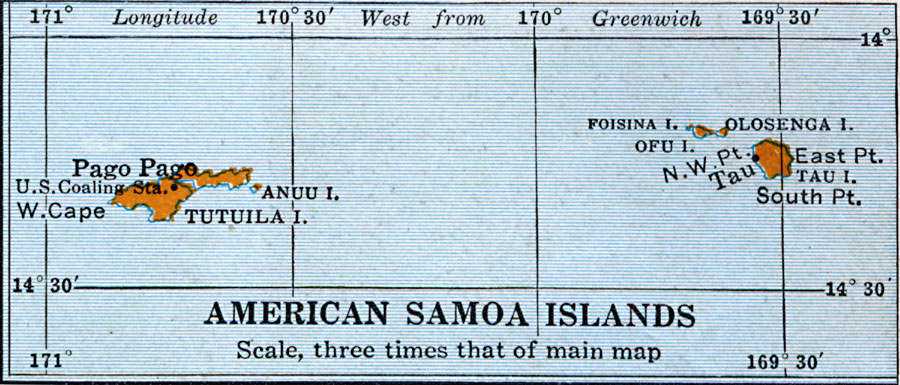
Description: A map of American Samoa Islands from 1920 showing the part of the Samoan Archipelago claimed by the United States under the Tripartite Convention of 1899, including the main island of Tutuila and Tau. The map shows the smaller neighboring islands, the U.S. coaling station for naval steamships, Pago Pago, and the port of Tau.
Place Names: American Samoa, Pago, �Ofu, �Oloseg
ISO Topic Categories: location,
inlandWaters,
oceans
Keywords: American Samoa Islands, physical, physical features, location,
inlandWaters,
oceans, Unknown, 1920
Source: Wallace W. Atwood, New Geography: Book Two (Boston, MA: Ginn and Company, 1920) 93
Map Credit: Courtesy the private collection of Roy Winkelman |
|