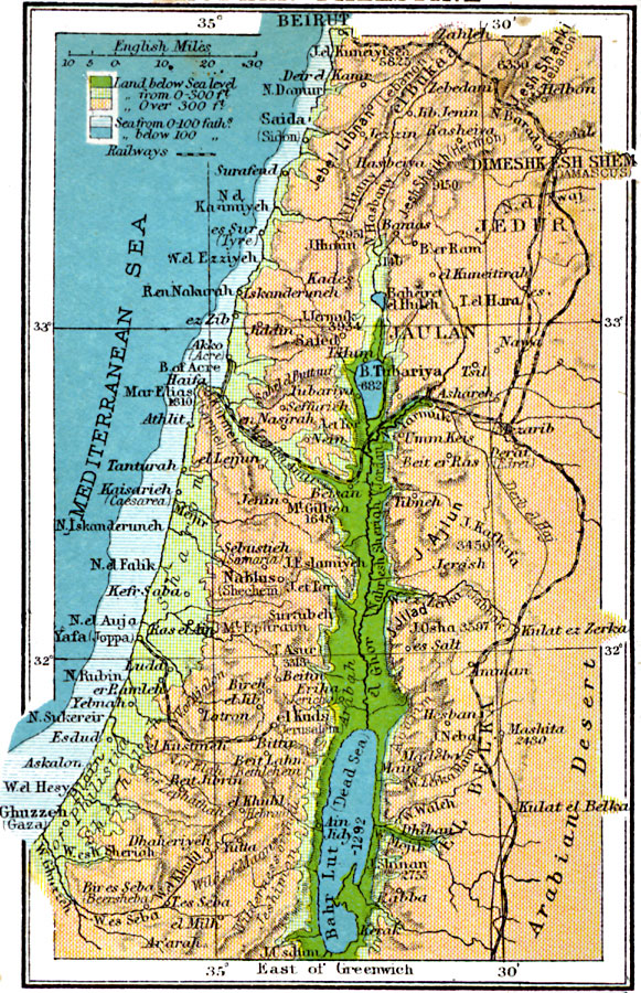
Description: A detail of the Jordan River region from 1920, showing major cities, trade centers, and ports along the Mediterranean, railways, travel routes including the Derb el Haj, rivers, lakes, terrain and coastal features. The map uses color-contouring to show land elevations from below sea level to above 300 feet, and water depths from sea level to 100 fathoms, and deeper than 100 fathoms. The elevations for prominent mountains are given, along with elevations below sea level along the Dead Sea depression. Place names are shown in classical and modern form for many cities, rivers, and territories.
Place Names: Palestine, Jaulan, �Kades, �Nablus, �el Kuds, �Beit Lahn, �Tanturah, �Saida, �Yebnah, �Ghuzzeh, �Ain Jidy, �Amma
ISO Topic Categories: inlandWaters,
location,
oceans,
transportation,
elevation
Keywords: Jordan River Region, physical, �transportation, physical features,
topographical, railroads, inlandWaters,
location,
oceans,
transportation,
elevation, Unknown, 1920
Source: , Asprey's Atlas of the World (London, England: Asprey and Co., Ltd., 1920) 79
Map Credit: Courtesy the private collection of Roy Winkelman |
|