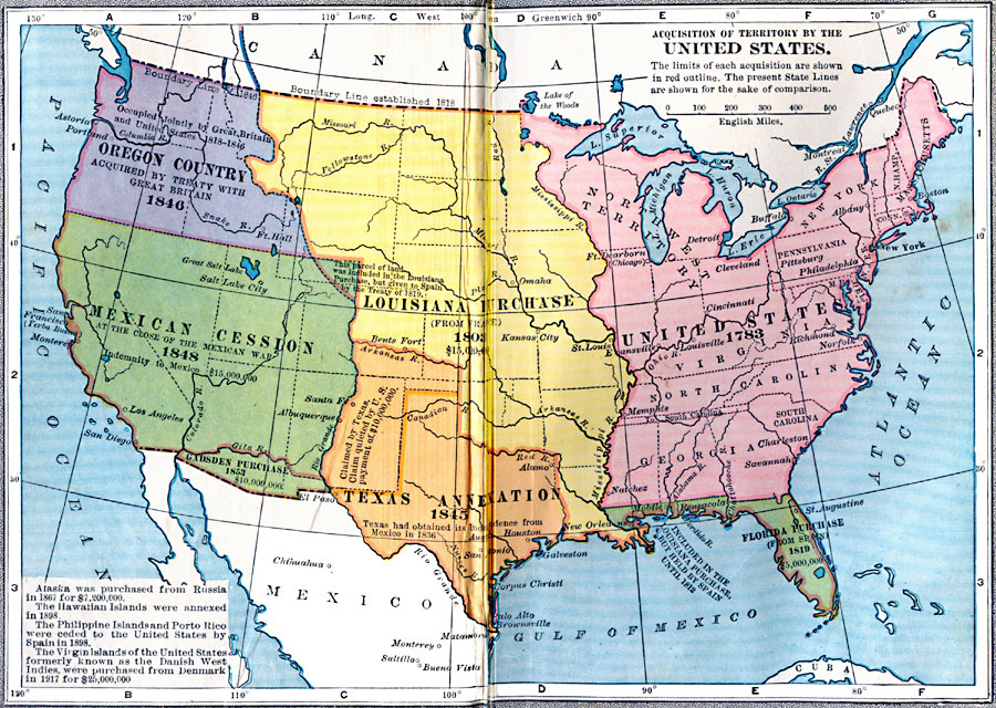
Description: A map from 1922 of the United States showing the acquisition of territory from 1783 to the purchase of the Dutch West Indies (Virgin Islands) in 1917. This map is color–coded to show each of the acquisitions with map notations giving dates and where applicable, purchase amounts, including the purchase of Alaska in 1867, the annexation of Hawaii in 1898, Philippine Islands and Puerto Rico ceded by Spain in 1898, and the purchase of the Virgin Island from the Dutch in 1917.
Place Names: Growth of Nation, Texas, �Louisiana Purchase, �Mexican Cession, �Oregon Country, �Original Colonies, �Florida Purchase, �Gadsden Purchas
ISO Topic Categories: location,
oceans,
inlandWaters
Keywords: Acquisition of Territory by the United States, physical, physical features, location,
oceans,
inlandWaters, Unknown, 1783–1917
Source: , Putnam's Handy Map Book (New York, NY: G. P. Putnam's Sons, 1922)
Map Credit: Courtesy the private collection of Roy Winkelman |
|