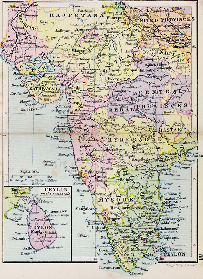
Description: A map from 1920 of the western portion of the Indian Empire from Sind along the Indus River to the Central Provinces, and south to Madras Province. The map shows Feudatory Native States in yellow, the province boundaries at the time, major cities, ports, railways, rivers, and coastal features of the region. An inset map details the island of Ceylon (Sri Lanka).
Place Names: India , Rajputana, �United Provinces, �Central India, �Kathiawa, �Central Provinces, �Berar, �Bombay, �Madras, �Mysore, �Ceylo
ISO Topic Categories: boundaries,
inlandWaters,
location,
oceans,
transportation
Keywords: Indian Empire — Western Portion, physical, �political, �transportation, physical features, country borders,
major political subdivisions, railroads, boundaries,
inlandWaters,
location,
oceans,
transportation, Unknown, 1920
Source: , Asprey's Atlas of the World (London, England: Asprey and Co., Ltd., 1920) 88
Map Credit: Courtesy the private collection of Roy Winkelman |
|