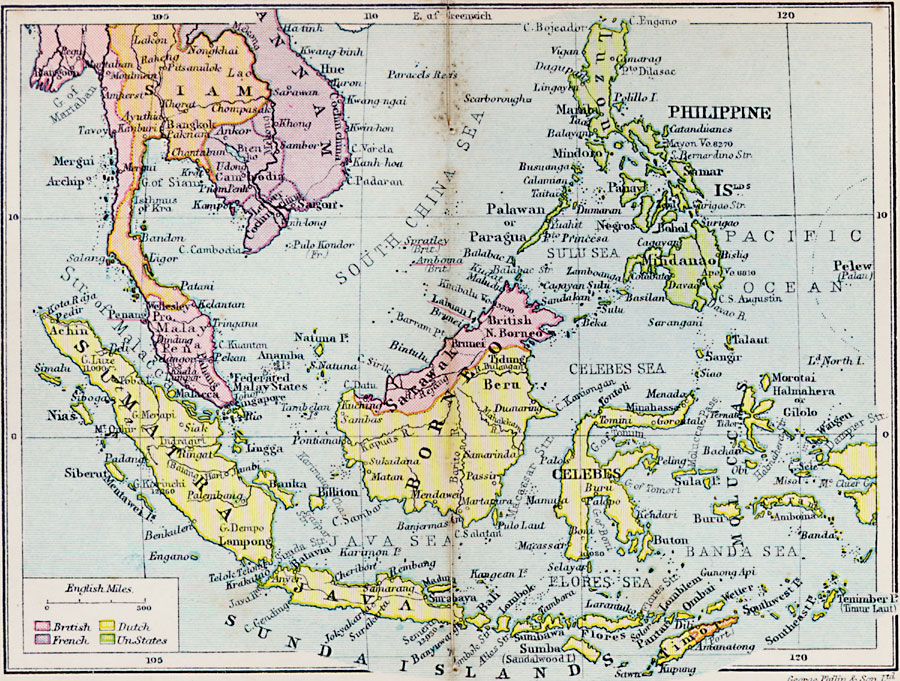
Description: A map from 1920 of the Indonesian region showing the political boundaries and foreign possessions at the time for the Sunda Islands, Borneo, Celebes, the Moluccas, the Philippines, the Province of Malay Peninsula, and portions of Siam (Thailand) and French Indo–China (Annam, Cambodia, and Cochin China). The map is color–coded to show the possessions of the British, French, Dutch, and the United States. The map also shows the Portuguese possession of East Timor.
Place Names: Indonesia, Siam, �Annam, �Sumatra, �Java, �Borneo, �Celebes, �Philippine Islands, �Mala
ISO Topic Categories: boundaries,
inlandWaters,
location,
oceans
Keywords: East Indies, physical, �political, �British, �French, �Dutch, �United States, physical features, country borders, boundaries,
inlandWaters,
location,
oceans, Unknown, 1920
Source: , Asprey's Atlas of the World (London, England: Asprey and Co., Ltd., 1920) 90
Map Credit: Courtesy the private collection of Roy Winkelman |
|