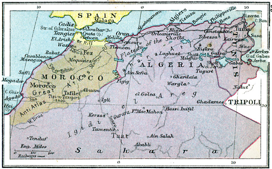
Description: A map of Morocco, Algeria, and Tunis in 1920 showing major cities, trade centers and railroads in the region. Lakes, rivers, and intermittent rivers are shown, as well as major landforms such as the Atlas and Anti–Atlas Mountains and the Plateau of the Shotts. The map also shows the strategically significant Spanish claims to Tangier and Melilla near the Strait of Gibraltar.
Place Names: A Regional Map of Africa, Morocco, �Algeria, �Tunis, �Algiers, �Fez, Cadiz, Strait of Gibraltar, Casablanca, Igidi el Areg, Tuat
ISO Topic Categories: boundaries,
inlandWaters,
location,
oceans,
transportation
Keywords: Algeria, Tunis and Morocco, physical, �political, �transportation, physical features, country borders, railroads, boundaries,
inlandWaters,
location,
oceans,
transportation, Unknown, 1920
Source: , Asprey's Atlas of the World (London, England: Asprey and Co., Ltd., 1920) 99
Map Credit: Courtesy the private collection of Roy Winkelman |
|