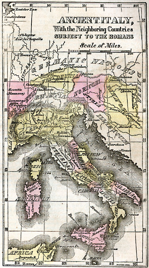
Description: Map of Ancient Italy with the neighboring countries subject to the Romans. This map shows the names of provinces in Latin, including Etruria, Latium, Campania, Umbria, Picenum, Samnium, Apulia, Calabria, Lucania, and Ager, with neighboring countries including Illyricum, Sal Pine Gaul, Noricum, Vin Delicia, and others. Important cities of the era are shown.
Place Names: Italy, Adriatic Sea, �Calabria, �Corsica, �Dacia, �Etruria, �Illyrium, �Italy, �Noricum, �River Danube, �Sardinia, �Sicily, �Umbri
ISO Topic Categories: inlandWaters,
location,
oceans
Keywords: Ancient Italy, historical, kRomanEmpire, country borders, inlandWaters,
location,
oceans, Unknown, Circa 800 BC
Source: Marcius Willson, Willson's Outlines of History (New York, NY: Ivison & Phinney, 1859) 579
Map Credit: Courtesy the private collection of Roy Winkelman |
|