mapsMaps ETC Site map
 Maps ETC > Europe > Iberian Peninsula > Map of Spain and Portugal with the divisions best known in history, 1789
Site Map 

Map of Spain and Portugal with the divisions best known in history, 1789

Map of Spain and Portugal with the divisions best known in history


Title: Map of Spain and Portugal with the divisions best known in history
Projection: Unknown,
Source Bounding Coordinates:
W: -8 E: 0 N: 42 S: 38

Main Map Page
Zoomify Version
B/W PDF Version
Color PDF Version
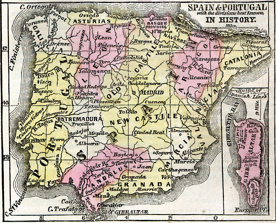
Description: A map of Spain and Portugal in 1789 showing the country borders, provinces, major cities, towns, and ports, and an inset map detailing Gibraltar at the time.
Place Names: Iberian Peninsula, Gibraltar, Portugal, Spai
ISO Topic Categories: inlandWaters, location, oceans
Keywords: Map of Spain and Portugal with the divisions best known in history, borders, historical, country borders, county borders, historical event, inlandWaters, location, oceans, Unknown, 1789
Source: Marcius Willson, Willson's Outlines of History (New York, NY: Ivison & Phinney, 1859) 589
Map Credit: Courtesy the private collection of Roy Winkelman
SearchLicensePDF HelpGIS Help Google Earth Help Zoomify Help

 Maps ETC > Europe > Iberian Peninsula > Map of Spain and Portugal with the divisions best known in history, 1789
Site Map