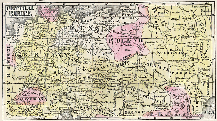
Description: A map from 1859 of central Europe showing the numerous German and Austrian states, Prussia, Poland, Switzerland, and portions of Italy, France, Belgium, Holland, Russia, and European Turkey. Principal cities and rivers are shown.
Place Names: Central Europe, Austria, �Belgium, �France, �Germany, �Holland, �Italy, �Poland, �Prussia, �Russia, �Turke
ISO Topic Categories: inlandWaters,
location,
oceans
Keywords: Central Europe, borders, �historical, country borders,
county borders, historical event, inlandWaters,
location,
oceans, Unknown, 1859
Source: Marcius Willson, Willson's Outlines of History (New York, NY: Ivison & Phinney, 1859) 597
Map Credit: Courtesy the private collection of Roy Winkelman |
|