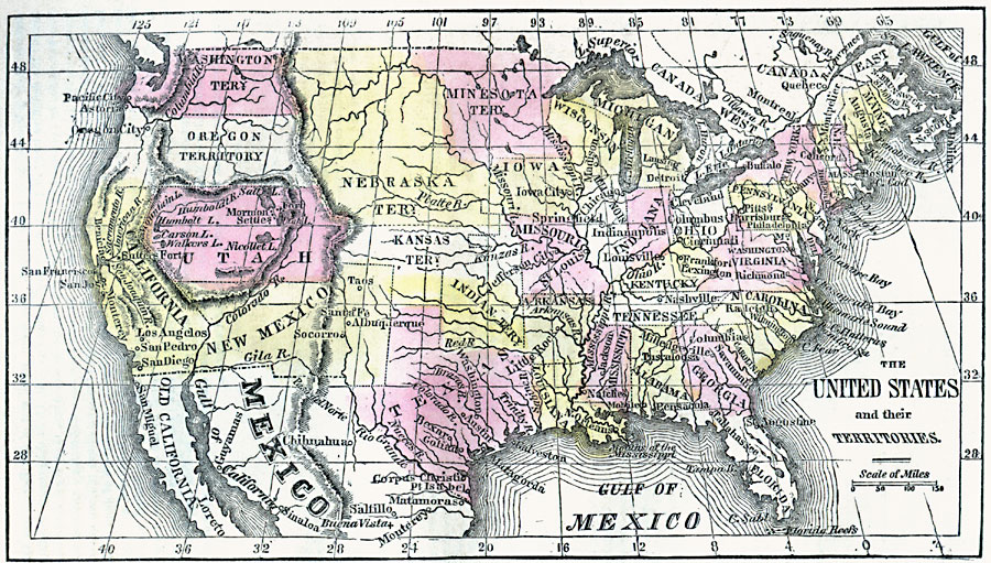
Description: A map from 1859 of the United States showing State and territory boundaries at the time, capitals and major cities, mountain systems, plains, lakes, rivers, and coastal features of the area.
Place Names: Growth of Nation, Indian Territory, �Maine, �Pennsylvania, �Virginia, �North Carolina, �Texas,�Oregon Territory, �Washington Territory, �American Revolutio
ISO Topic Categories: inlandWaters,
location,
oceans
Keywords: The United States, borders, �historical, country borders,
county borders, historical event, inlandWaters,
location,
oceans, Unknown, 1859
Source: Marcius Willson, Willson's Outlines of History (New York, NY: Ivison & Phinney, 1859) 599
Map Credit: Courtesy the private collection of Roy Winkelman |
|