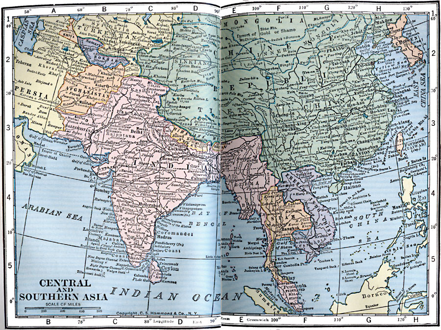
Description: A map from 1922 showing the country boundaries of central and southern Asia at the time. This map shows British India extending from Afghanistan and Persia (Iran) in the west to Burma (Myanmar) and along the Malay Peninsula in the east, and shows the British protectorate of the Federated Malay States. The map also shows French Indo–China, which included Tonkin, Annam, Laos, and Cambodia, and the Japanese territorial claims to Formosa (Taiwan) and Port Arthur in China. This map shows capitals and other major cities, ports, railways, lakes, rivers, coastal features, and islands of the region.
Place Names: Miscellaneous Asia, China, �India, �Mongolia, �Phillipines, �Siam, �French Indo-China, �Nepal, �Taiwan, �Formosa, �Chosen, �Korea, �Afghanistan, �Persia, �Turkestan, �Omen, �Khiva, �Bokhara,
ISO Topic Categories: boundaries,
location,
inlandWaters,
oceans
Keywords: Central and Southern Asia, physical, �political, physical features, country borders, boundaries,
location,
inlandWaters,
oceans, Unknown, 1922
Source: , Putnam's Handy Map Book (New York, NY: G. P. Putnam's Sons, 1922) 42-43
Map Credit: Courtesy the private collection of Roy Winkelman |
|