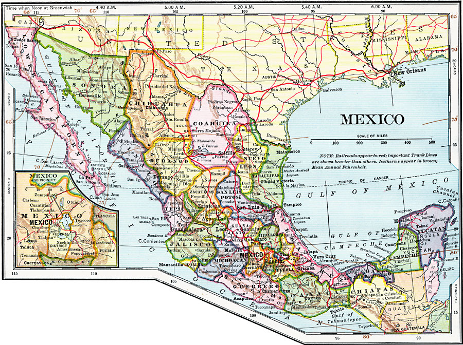
Description: A map from 1902 of Mexico showing the states and state capitals, major cities and towns, trunk and secondary railroad lines, mountains, and coastal features. This map shows isotherms of mean annual temperature in degrees Fahrenheit, and local times are shown at the top of the map, based on noon Greenwich. An inset map shows the City of Mexico, the Federal District, and vicinity, including the lakes, railroads, mountains, and neighboring cities.
Place Names: Mexico,
ISO Topic Categories: oceans,
location,
inlandWaters
Keywords: Mexico, borders, �historical, �transportation, �meteorological, physical features, railroads,
water routes, climate, oceans,
location,
inlandWaters, Unknown, 1902
Source: H. Justin Roddy, Complete Geography (New York, NY: American Book Company, 1902) 76
Map Credit: Courtesy the private collection of Roy Winkelman |
|