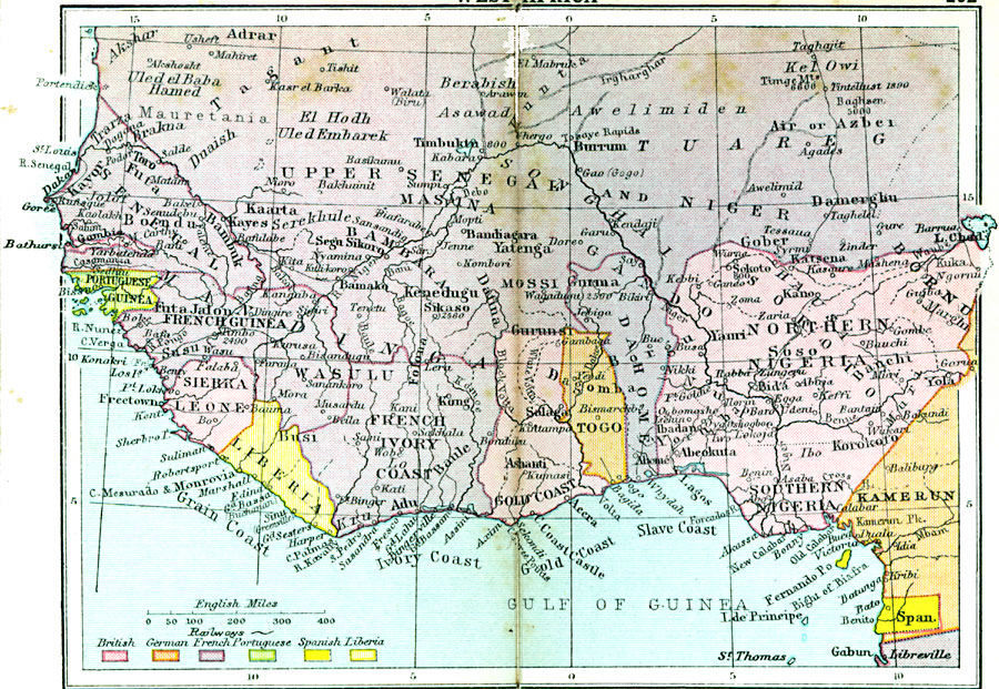
Description: Map of Western Africa in 1920 showing the Upper Guinea States of Gambia, Portuguese Guinea, Sierra Leon, Liberia, British Gold Coast, Togo, Dahomey, Northern and Southern Nigeria, Kamerun, and Spanish Guinea. The map also shows the French territories of Senegal, Upper Senegal and Niger, French Guinea, and French Ivory Coast. The map shows major cities, ports, and trade centers, railroads, rivers, and mountain systems.
Place Names: A Regional Map of Africa, Adrar, �Kayor, �Toro, �Bondu, �Bambuk, �Kaarta, �Bamako, �Timbuktu, �Burrum, �Damerghu, �Gober, �Kasena, �Kano, �Sokoto, �Yauri, �Abeokuta, �Korokoto, �Salaga, �Ad
ISO Topic Categories: boundaries,
inlandWaters,
location,
oceans,
transportation
Keywords: Colonial West Africa, physical, �political, �transportation, physical features, country borders, railroads, boundaries,
inlandWaters,
location,
oceans,
transportation, Unknown, 1920
Source: , Asprey's Atlas of the World (London, England: Asprey and Co., Ltd., 1920) 102
Map Credit: Courtesy the private collection of Roy Winkelman |
|