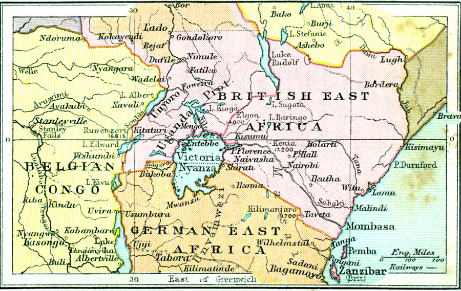
Description: A map of the region around Lake Victoria, or Victoria Nyanza, in 1920, showing the northern portion of German East Africa, the eastern portion of Belgian Congo, and all of British East Africa including the Uganda Protectorate. The map shows neighboring lakes, rivers, and mountains, with summit elevations for Kilimanjaro, Kenia, Elgon, and Ruwenzori. The map also shows major cities, ports, trade centers, railroads, and the British controlled islands of Pemba and Zanzibar. The traditional lands of the Masai and Unvamwezi are shown.
Place Names: A Regional Map of Africa, British East Africa, �Belgian Congo, �German East Africa, �Mombasa, �Zanzibar, Pemba, Nairobi, Stanleyville, Tabora, Uganda
ISO Topic Categories: boundaries,
inlandWaters,
location,
oceans,
transportation
Keywords: The Lake Victoria Region, physical, �political, �transportation, physical features, country borders, railroads, boundaries,
inlandWaters,
location,
oceans,
transportation, Unknown, 1920
Source: , Asprey's Atlas of the World (London, England: Asprey and Co., Ltd., 1920) 103
Map Credit: Courtesy the private collection of Roy Winkelman |
|