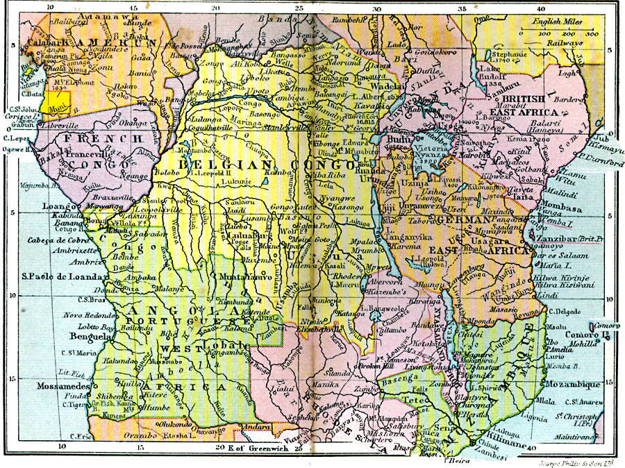
Description: A map of central Africa in 1920 showing the European colonial claims at the time. The map shows Spanish Guinea, Kamerun, French Congo, Belgian Congo, Uganda Protectorate, British East Africa, German East Africa, Mozambique, Angola, and the northern portion of Rhodesia. This map also shows the Caprivi Strip, a strategic corridor linking German Southwest Africa to the Zambizi River in what was then Rhodesia, and thereby access to the west coast of Africa and the territory of German East Africa. The map shows major cities, ports, trade centers, railroads, lakes, rivers, and mountains with summit elevations for prominent peaks. The traditional lands for major native tribes are also labeled.
Place Names: A Regional Map of Africa, Kamerun, �French Congo, �Belgian Congo, �Uganda, �British East Africa, �German East Africa, �Angola, �Rhodesia, �Mozambiqu
ISO Topic Categories: boundaries,
inlandWaters,
location,
oceans,
transportation
Keywords: Central Africa, physical, �political, �transportation, physical features, country borders, railroads, boundaries,
inlandWaters,
location,
oceans,
transportation, Unknown, 1920
Source: , Asprey's Atlas of the World (London, England: Asprey and Co., Ltd., 1920) 104
Map Credit: Courtesy the private collection of Roy Winkelman |
|