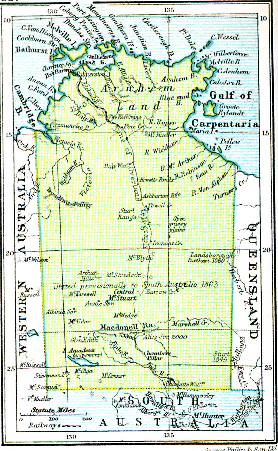
Description: A map of Australia's Northern Territory in 1920 showing cities, railway, and the route of the overland telegraph, as well as rivers, lakes, mountains, and coastal features.
Place Names: Northern Territory, Melville Island, �Bathurst Island, �Coburg Peninsula, �Port Essington, �Goulburn Island
ISO Topic Categories: boundaries,
inlandWaters,
location,
oceans,
transportation,
utilitiesCommunication
Keywords: Northern Territory, physical, �transportation, physical features, railroads, boundaries,
inlandWaters,
location,
oceans,
transportation,
utilitiesCommunication, Unknown, 1920
Source: , Asprey's Atlas of the World (London, England: Asprey and Co., Ltd., 1920) 117
Map Credit: Courtesy the private collection of Roy Winkelman |
|