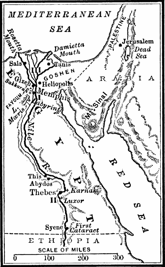
Description: This map shows the sites of several ancient Egyptian dynasties along the Nile River. The seats of the Old Empire (I) near Memphis (4000–2700 BC, first through tenth dynasties), the Middle Empire (II) near Thebes (2700–1670 BC, eleventh through seventeenth dynasties), and the New Empire (III) near Tanis and Sais (1670–525 BC, eighteenth through twenty–sixth dynasties to the time of the Persian conquest) are shown.
Place Names: Egypt, Egypt, �Jerusalem, �Thebes, Rosetta Mouth, Damietta Mouth, Tanis, Sais, Gizeh, Sakkarah, Heliopolis, Memphis, Fayoum, Abydos, Karnak, Luxor, Syene
ISO Topic Categories: oceans,
location,
inlandWaters
Keywords: Egypt, borders, �political, kAncientEgypt, major political subdivisions, oceans,
location,
inlandWaters, Unknown, 1908
Source: William C. Morey, Outlines in Greek History with a survey of Ancient Oriental Nations (New York, NY: The Athenium Press, 1908) 46
Map Credit: Courtesy the private collection of Roy Winkelman |
|