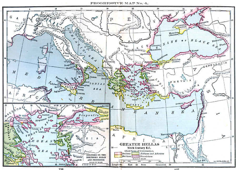
Description: Map showing Greater Hellas in sixth century B.C. Map is color–coded to show lands controlled by the Dorians, the Ionians, the Phoenicians, and the Aeolian and Achaean peoples.
Place Names: Regional Mediterranean, Africa, �Asia, �Europ
ISO Topic Categories: borders, �political, kWorldMedSea, kWorldAfroAsia, kWorldEurasia
Keywords: Greater Hellas , borders, �political, major political subdivisions, borders, �political, kWorldMedSea, kWorldAfroAsia, kWorldEurasia, Unknown, Sixth Century B.C.
Source: William C. Morey, Outlines in Greek History with a survey of Ancient Oriental Nations (New York, NY: The Athenium Press, 1908) 136-137
Map Credit: Courtesy the private collection of Roy Winkelman |
|