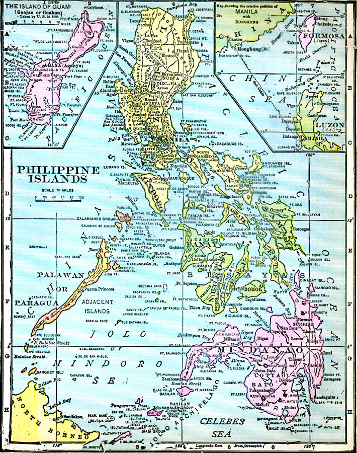
Description: A map from 1920 of the Philippine Islands, showing the province boundaries at the time, the capital of Manila and other major cities, railways, terrain, rivers, and coastal features of the island group. The map is color–coded, breaking the island group into the northern section of Luzon, Mindoro, and neighboring islands, a central section of the Bisayas (Visayas) islands, with Panay, Negros, Cebu, Bohol, Leyte, and Samar, a western section of the Palawan or Paragua Archipelago, and a southern section of Mindanao and the Sulu or Jolo Archipelago. The map includes an inset of the island of Guam (Guajan or Guahan) taken by the United States in 1898 under the Treaty of Paris at the end of the Spanish–American War (December 10, 1898), and an inset showing the relative position of Manila with Hong Kong, China. The inset map also shows the submarine telegraph cable between Manila and Hong Kong, and shows the island of Formosa (Taiwan) as a possession of Japan at the time.
Place Names: Philippines, Angeles, �Baguio, �Batangas, �Butuan, �Cagayan De Oro, �Legaspi, �Manila, �Puerto Princesa, �Quezon city, �San Fernanad
ISO Topic Categories: oceans,
inlandWaters,
location
Keywords: Philippine Islands, borders, oceans,
inlandWaters,
location, Unknown, 1920
Source: James M. Miller and H.S. Canfield, The People's War Book - History, Cyclopedia, and Chronology of the Great War (Cleveland, OH: R.C. Barnum Co., 1920) 295
Map Credit: Courtesy the private collection of Roy Winkelman |
|