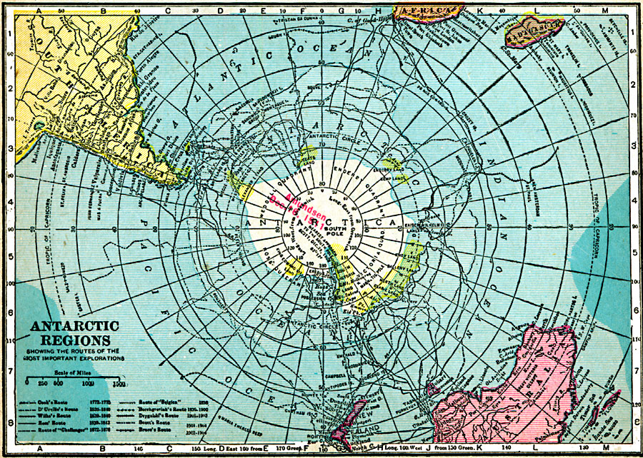
Description: A map of the South Polar Region from 1920 showing the routes of several Antarctic explorations. The map shows the date Amundsen first reached the South Pole (December 16, 1911), and routes of Cook (1772–1775), D'Urville (1838–1840), Wilke (1839–1840), Ross (1839–1843), Borchgrevink (1898–1900), Drygalaki (1901–1903), Scott (1901–1904), Bruce (1902–1904), and Shackleton (1909). This map shows Antarctica divided into the Wendell Quadrant, Enderby Quadrant, Victoria Quadrant, and Ross Quadrant.
Place Names: Antarctic Region, Davis (Australia), �Dumont dUrville (France), �Maitri (India), �Mcmurdo (U.S.), �Mostok (Russia), �Neumayer (Germany), �Orcadas (Argentina), �Sanae IV (South Africa), �Syowa (Japan), �Zhong Shan (China
ISO Topic Categories: oceans,
inlandWaters,
location
Keywords: Exploration of the Antarctic Regions, borders, oceans,
inlandWaters,
location, Unknown, 1920
Source: James M. Miller and H.S. Canfield, The People's War Book - History, Cyclopedia, and Chronology of the Great War (Cleveland, OH: R.C. Barnum Co., 1920) 336
Map Credit: Courtesy the private collection of Roy Winkelman |
|