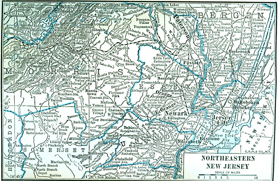
Description: Northeastern counties of New Jersey, showing railroads, towns, cities, and rivers.
Place Names: New Jersey, Paterson, �Newark, �Jersey City, �Elizabet
ISO Topic Categories: boundaries,
location,
inlandWaters
Keywords: Northeastern New Jersey, physical, physical features, boundaries,
location,
inlandWaters, Unknown, 1922
Source: , Putnam's Handy Map Book (New York, NY: G. P. Putnam's Sons, 1922) 253
Map Credit: Courtesy the private collection of Roy Winkelman |
|