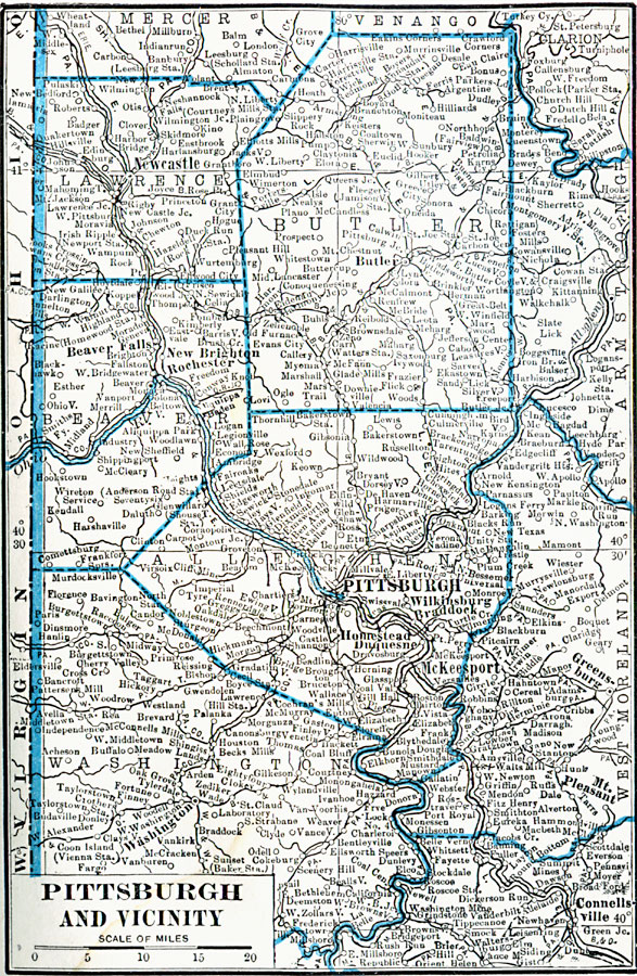
Description: A map from 1922 of Pittsburgh and vicinity showing neighboring counties, the Allegheny, Monongahela, and Ohio Rivers, city limits, principal roads, railroads, neighboring cities and towns, and rivers.
Place Names: Pennsylvania, Pittsburg, �Newcastle, �Greensburg, �Connellsville, �Washington, �Rochester, �Butler,
ISO Topic Categories: boundaries,
location,
inlandWaters
Keywords: Pittsburgh and Vicinity, physical, physical features, boundaries,
location,
inlandWaters, Unknown, 1922
Source: , Putnam's Handy Map Book (New York, NY: G. P. Putnam's Sons, 1922) 285
Map Credit: Courtesy the private collection of Roy Winkelman |
|