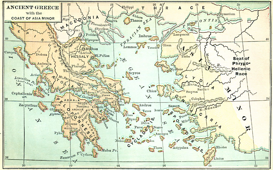
Description: Countries bordering the Aegean Sea and the eastern side of the Ionian Sea.
Place Names: Regional Mediterranean, Macedonia, �Thrace, �Asia Minor, �Peloponnesus, �Aetolia, �Epirus, �Thessaly, �Cyclades Islands, �Lydia, �Caria, �Ionia, �Sporades Islands, �Aegean Sea, �Ionian Sea,
ISO Topic Categories: physical, kWorldMedSea
Keywords: Ancient Greece and the Coast of Asia Minor, physical, physical features, physical, kWorldMedSea, Unknown, 1100–800 B.C.
Source: John D. Quackenbos, Illustrated History of Ancient Literature, Oriental and Classical (New York, New York: Harper and Brothers, 1901) 132
Map Credit: Courtesy the private collection of Roy Winkelman |
|