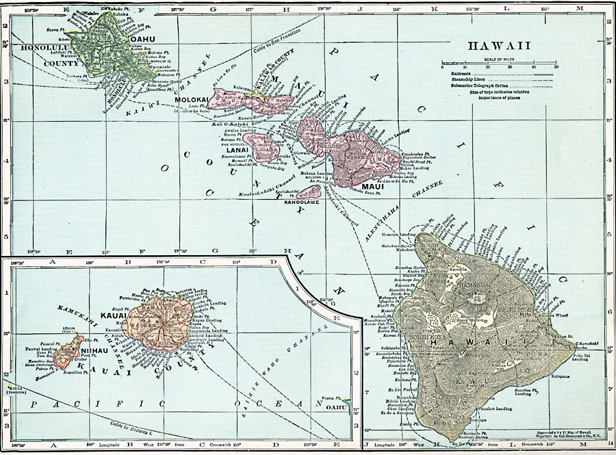
Description: A map from 1920 of the Hawaiian Islands showing the eight main islands of Hawaii, Maui, Kahoolawe, Lanai, Molokai, Oahu, and in the inset Kauai and Niihau, the capital of Honolulu on the island of Oahu, cities, towns, ports, railroads, submarine cable routes, volcanoes, and coastal features. The map is color–coded to show the island counties of Kauai County (Kauai and Niihau), Honolulu County (Oahu), Kalawao County on Molokai, Maui County (Maui, Kahoolawe, Lanai, and most of Molokai), and Hawaii County.
Place Names: Hawaii, Honolulu, �Waimea, �Kuamalapau, �Paho
ISO Topic Categories: boundaries,
location,
oceans,
transportation
Keywords: Hawaii, physical, physical features, boundaries,
location,
oceans,
transportation, Unknown, 1920
Source: , Hammond's Modern Atlas of the World (New York, NY: C. S. Hammond and Company, Inc., 1920) 30
Map Credit: Courtesy the private collection of Roy Winkelman |
|