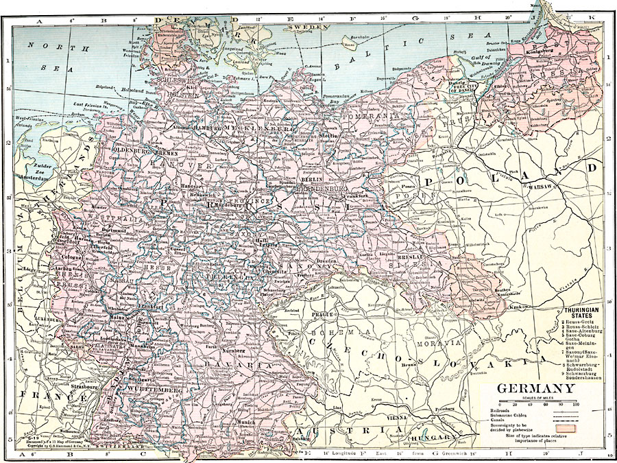
Description: A map of Germany in 1920, showing major cities, railroads, submarine cables, and canals, with a reference key to the nine Thuringian States. The map is color–coded to show the territories of southern Silesia, southern East Prussia, Sarre, and northern Schleswig, whose sovereignty was to be decided by plebiscite.
Place Names: Germany, Berlin, �Cologne, �Bremen, �Hamburg, �Hannover, �Mannheim, �Dresden, �Frankfurt am Main, �Nurember
ISO Topic Categories: boundaries,
location,
inlandWaters,
transportation
Keywords: Germany, physical, �transportation, physical features, railroads,
water routes, boundaries,
location,
inlandWaters,
transportation, Unknown, 1920
Source: , Hammond's Modern Atlas of the World (New York, New York: C. S. Hammond and Company, Inc., 1920) 43
Map Credit: Courtesy the private collection of Roy Winkelman |
|