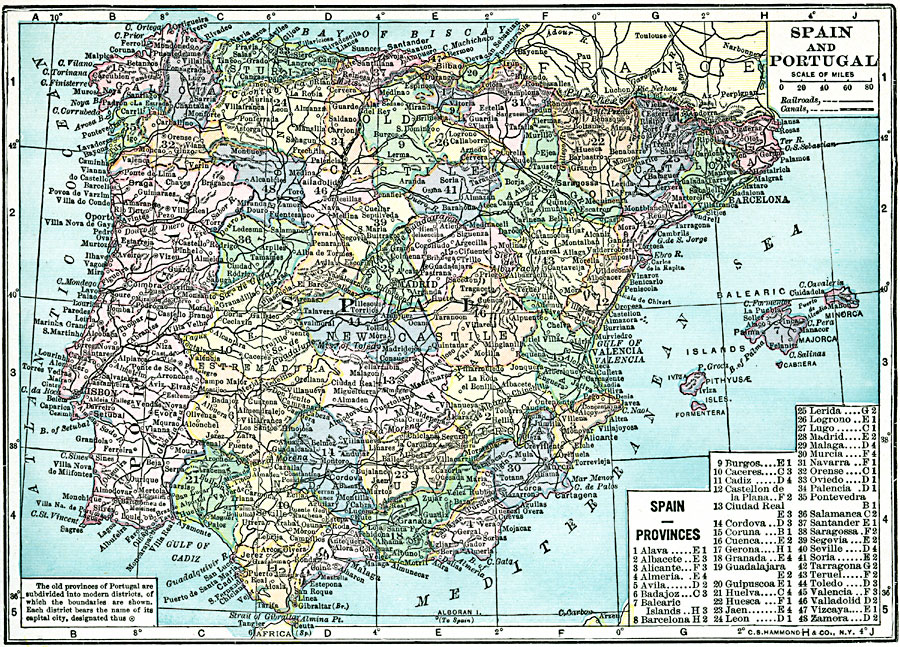
Description: A map of Spain and Portugal in 1920, showing major cities, towns, railroads and canals. The old provinces of Spain are shown, with the modern districts color–coded and numerically referenced on the key. The modern districts of Portugal are shown with each district bearing the name of its capital city.
Place Names: Iberian Peninsula, Portugal, �Spain, �Madrid, �Lisbon,
ISO Topic Categories: boundaries,
location,
inlandWaters,
oceans,
transportation
Keywords: Spain and Portugal, physical, �transportation, physical features, railroads,
water routes, boundaries,
location,
inlandWaters,
oceans,
transportation, Unknown, 1920
Source: , Hammond's Modern Atlas of the World (New York, NY: C. S. Hammond and Company, Inc., 1920) 49
Map Credit: Courtesy the private collection of Roy Winkelman |
|