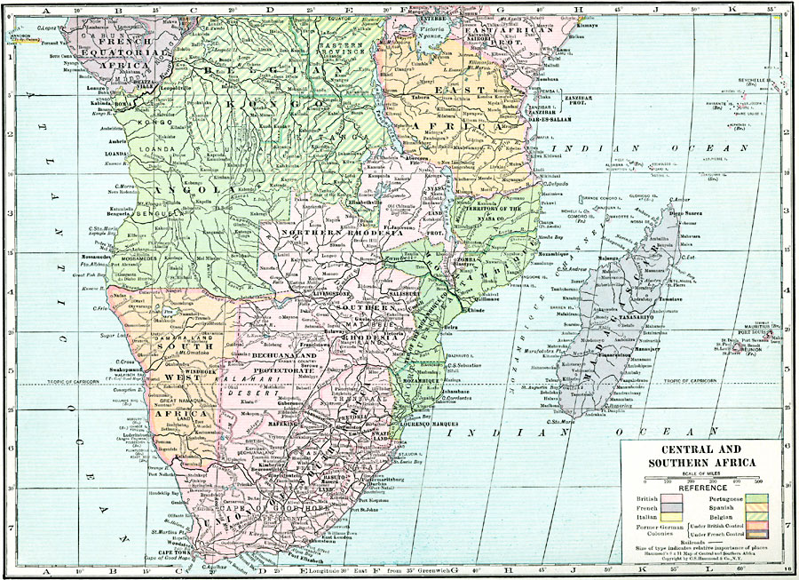
Description: A map of central and southern Africa in 1920 showing colonial possessions of the British, French, Italian, Portuguese, Spanish, and Belgians, including the former German colonies, lost after WWI, to French and British control per the Treaty of Versailles. This map shows major cities and trade centers, railroads, major rivers, deserts, and landforms.
Place Names: A Regional Map of Africa, French Equatorial Africa, �Belgian Kongo, �Angola, �East Africa, �Mozambique, �Rhodesia, �South West Africa, �Union of South Africa, �Bechuanaland Protectorate,�Madagascar
ISO Topic Categories: boundaries,
inlandWaters,
location,
oceans,
transportation
Keywords: Post-WWI Central and Southern Africa, physical, �transportation, kVersailles, physical features, railroads, boundaries,
inlandWaters,
location,
oceans,
transportation, Unknown, 1920
Source: , Hammond's Modern Atlas of the World (New York, New York: C. S. Hammond and Company, Inc., 1920) 52
Map Credit: Courtesy the private collection of Roy Winkelman |
|