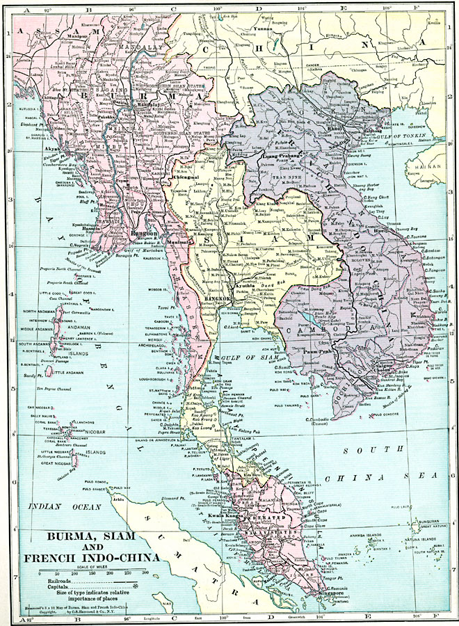
Description: A map from 1920 of Burma, Siam, and French Indo-China at the time. The map shows the British possessions of British India (extending to Assam and Burma, or Myanmar) and the Federated Malay States (under protectorate of Britain) in pink, Siam or Thailand in yellow, and French Indo–China possessions, including Tonkin, Annam, Laos, Cambodia, and Cochin China, in purple. The map shows major cities and ports, railroads, lakes, rivers, coastal features, and islands of the region.
Place Names: Southeastern Asia, Burma, �Mandalay, �Rangoon, �Siam, �Bangkok, �French Indo-China, �Hanoi, �Singapore, �Saigon,
ISO Topic Categories: boundaries,
inlandWaters,
location,
oceans,
transportation
Keywords: Burma, Siam, and French Indo-China, physical, �transportation, physical features, railroads, boundaries,
inlandWaters,
location,
oceans,
transportation, Unknown, 1920
Source: , Hammond's Modern Atlas of the World (New York, NY: C. S. Hammond and Company, Inc., 1920) 59
Map Credit: Courtesy the private collection of Roy Winkelman |
|