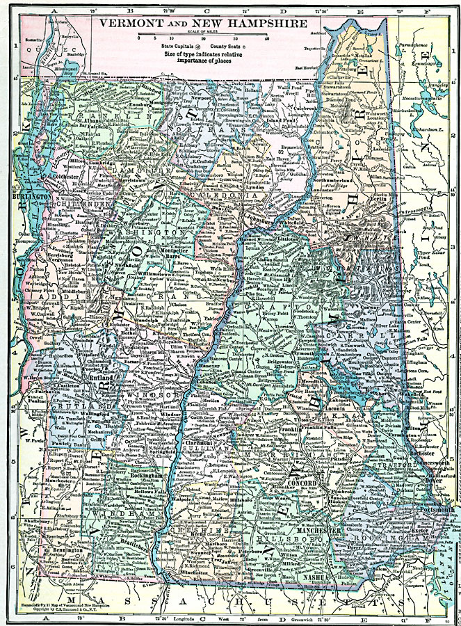
Description: Vermont and New Hampshire, showing physical features.
Place Names: New England States, Vermont, �Montpelier, �Burlington, �New Hampshire, �Concord, �Manchester, �Nashua, �Portsmouth, �Rochester, �Dover, ��New Englan
ISO Topic Categories: boundaries,
location,
inlandWaters
Keywords: Vermont and New Hampshire, physical, �political, physical features, county borders, boundaries,
location,
inlandWaters, Unknown, 1920
Source: , Hammond's Modern Atlas of the World (New York, NY: C. S. Hammond and Company, Inc., 1920) 65
Map Credit: Courtesy the private collection of Roy Winkelman |
|