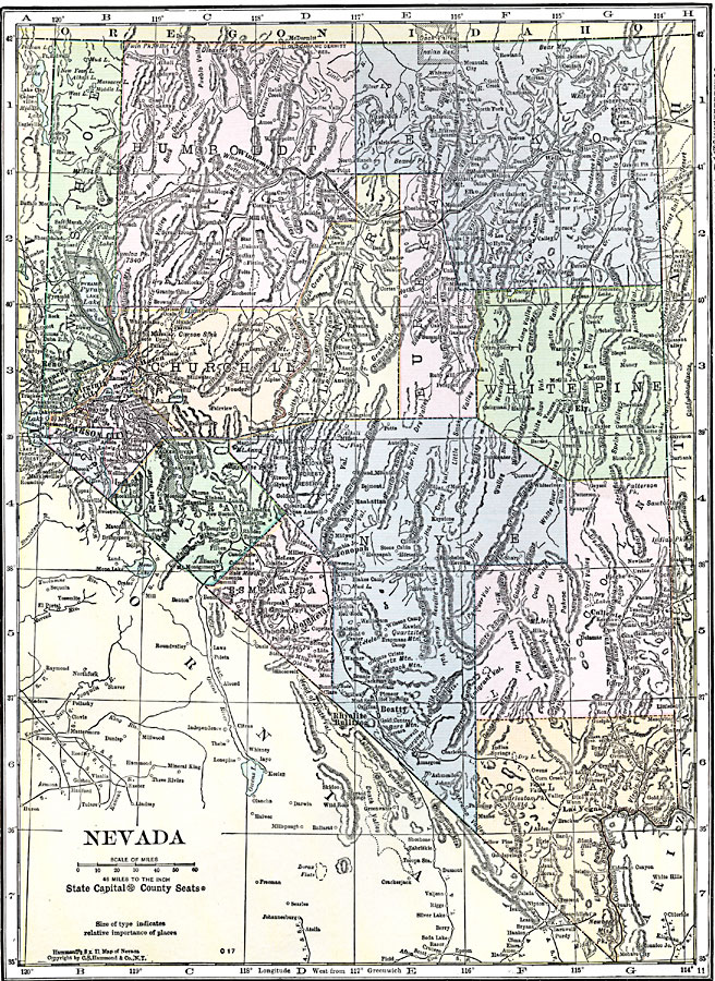
Description: A map from 1920 of Nevada showing the capital of Carson City, counties and county seats, principal cities and towns, Indian reservations,railroads, mountains, lakes, and rivers.
Place Names: Nevada, Carson City, �Austin, �Elko, �Virginia City, �Las Vegas, �Reno, �Tonopah, �Winnemucc
ISO Topic Categories: boundaries,
location,
inlandWaters
Keywords: Nevada, physical, �political, kNativeAmerican, physical features, county borders, boundaries,
location,
inlandWaters, Unknown, 1920
Source: , Hammond's Modern Atlas of the World (New York, NY: C. S. Hammond and Company, Inc., 1920) 125
Map Credit: Courtesy the private collection of Roy Winkelman |
|