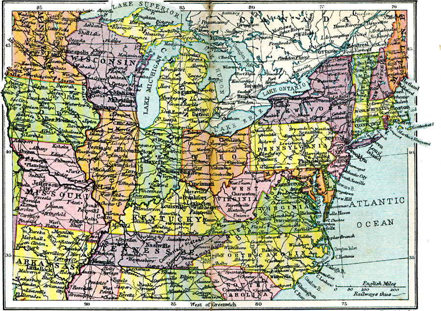
Description: First in a series of regional maps of the United States.
Place Names: Miscellaneous United States, New York, �Boston, �Portland, �Norfolk, �Raleigh, �Washington D.C., �Annapolis, �Philadelphia, �Buffalo, �Detroit, �Lansing, �Chicago, �Cincinnati, �Louisville, �Little Rock, �Milwaukee, �Chicago, �Mississippi River, �Atlantic Ocean, �Southern United S
ISO Topic Categories: boundaries,
inlandWaters,
location,
oceans,
transportation
Keywords: Northern United States, physical, �political, �transportation, physical features, country borders,
major political subdivisions, railroads, boundaries,
inlandWaters,
location,
oceans,
transportation, Unknown, 1920
Source: , Asprey's Atlas of the World (London, England: Asprey and Co., Ltd., 1920) 134
Map Credit: Courtesy the private collection of Roy Winkelman |
|