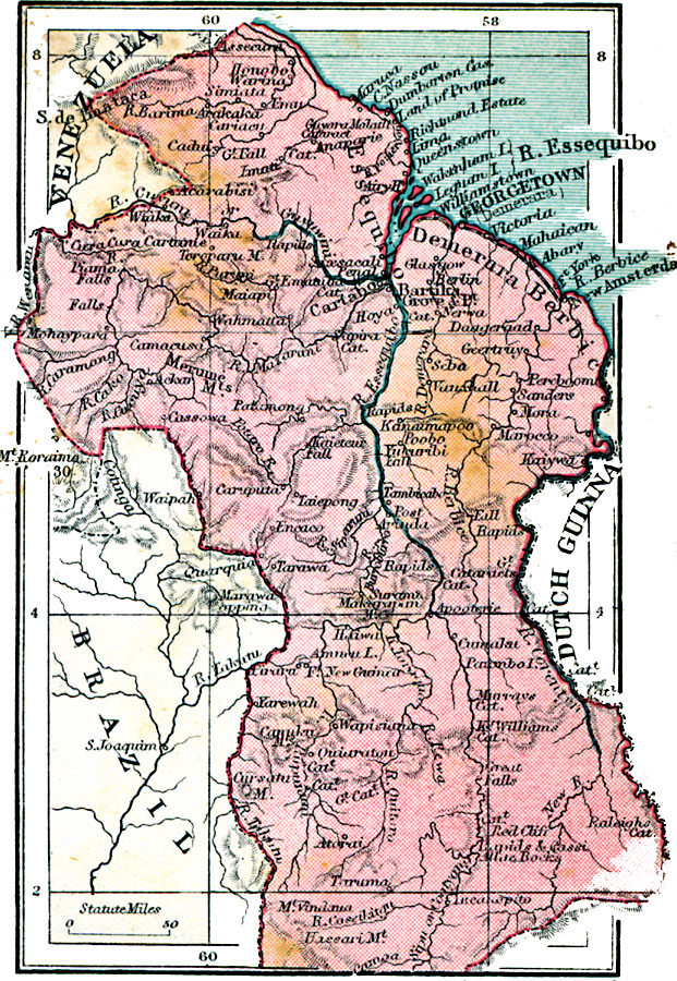
Description: A map from 1920 of British Guiana. The map shows the political boundaries at the time with Venezuela, Brazil, and Dutch Guiana, the districts of Essequibo, Demerara, and Berbice along the Atlantic coast (the original Dutch colonies), the capital city of Georgetown, other cities and towns, the railway between Georgetown and New Amsterdam, the Essequibo River and Cuyuni River, and mountains of the Guiana Highlands.
Place Names: Guyana, Georgetown, �Queenstown, �Merume, �Maiapi, �Cartabo, �Kaiywa, �Vauxhall, �Daageraad, �Bartik
ISO Topic Categories: boundaries,
inlandWaters,
location,
oceans
Keywords: British Guiana, physical, �political, physical features, country borders, boundaries,
inlandWaters,
location,
oceans, Unknown, 1920
Source: , Asprey's Atlas of the World (London, England: Asprey and Co., Ltd., 1920) 141
Map Credit: Courtesy the private collection of Roy Winkelman |
|