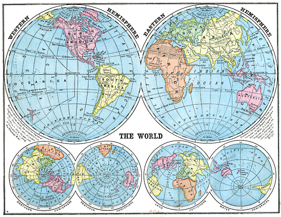
Description: A double hemisphere map of the earth from 1872 showing the world displayed in western and eastern hemispheres. This mapping convention of dividing the earth, bound by the 20° W and 160° E meridians, shows the "Old World" and "New World" with a minimum disruption of the landmasses. The map is color–coded to show the continents, and shows major cities, commercial products, rivers, and terrain features. The comparative time of day, given in Roman numerals and based on XII noon at London, is shown along the Equator. Inset maps show the world from a north and south polar view, and a "Land Hemisphere," "Water Hemisphere" view.
Place Names: A Complete Map of Globes and Multi-continent, Africa, �Antarctica, �Asia, �Australia, �Europe, �North America, �South Americ
ISO Topic Categories: inlandWaters,
location,
oceans
Keywords: Hemispheric Representations of the Earth, physical, physical features, inlandWaters,
location,
oceans, Unknown, 1872
Source: James Monteith, Comprehensive Geography (New York, New York: A. S. Barnes and Company, 1872) 14
Map Credit: Courtesy the private collection of Roy Winkelman |
|