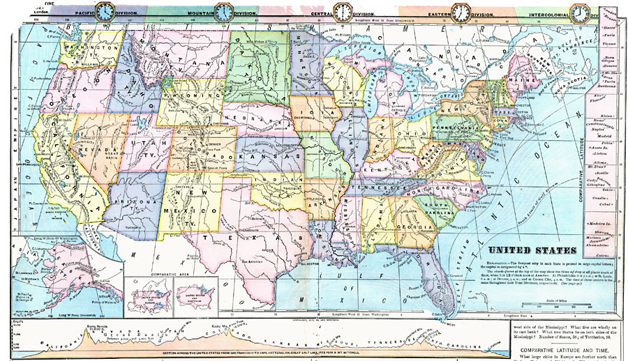
Description: A map from 1872 of the United States showing state boundaries and state capitals, major cities and towns, mountain systems, lakes, rivers, and coastal features. The map shows Yellowstone National Park, the first in the United States (1872). Clock symbols at the top of the map show local times based on noon, London. Ocean currents are shown, including the general boundaries of the Gulf Stream. Longitude from Greenwich is shown at the top of the map, and from Washington at the bottom. Comparative latitudes for various global locations are given in the side margins. Inset maps detail Alaska, and show the comparative area of the United States with Europe and Australia. At the bottom of the map is a chart showing a vertical profile along a line from San Francisco to Cape Hatteras via the Great Salt Lake, Pike's Peak, and Mt. Mitchell.
Place Names: A Complete Map of the United States, Boston, �Chicago, �Houston, �New Orleans, �New York, �Washington D.C
ISO Topic Categories: boundaries,
location,
inlandWaters,
oceans,
elevation
Keywords: United States, physical, �political, �hydrological, kComparativeArea, physical features, county borders, currents, boundaries,
location,
inlandWaters,
oceans,
elevation, Unknown, 1872
Source: James Monteith, Comprehensive Geography (New York, NY: A. S. Barnes and Company, 1872) 22-23
Map Credit: Courtesy the private collection of Roy Winkelman |
|