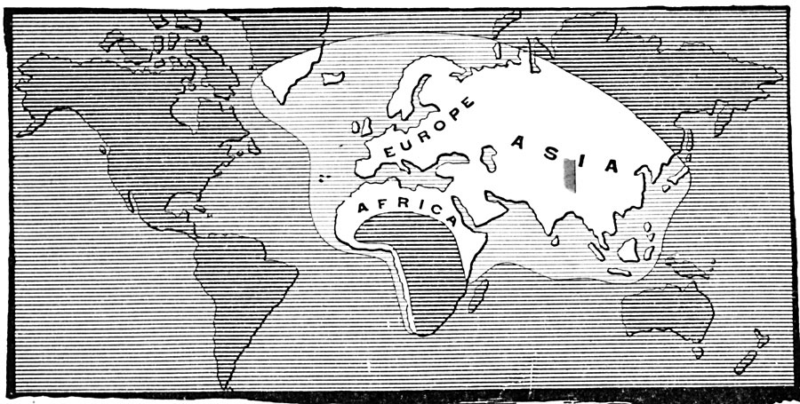
Description: A map from 1907 showing the extent of the European's known world in the time of Christopher Columbus (1451–1506), which reflects the explorations of the Norsemen (around AD 1000), travels of Marco Polo to China (1271–1295), and Vasco de Gama's Portuguese exploration of the west coast of Africa and India.
Place Names: A Complete Map of Globes and Multi-continent, Africa, �Asia, �Europ
ISO Topic Categories: oceans,
location,
inlandWaters
Keywords: The Part of the World Known at the time of Columbus, borders, �transportation, country borders, water routes, oceans,
location,
inlandWaters, Unknown, Late 1400s
Source: Gertrude van Duyn Southworth, A First Book in American History (New York, NY: D. Appleton and Co. , 1907) 4
Map Credit: Courtesy the private collection of Roy Winkelman |
|