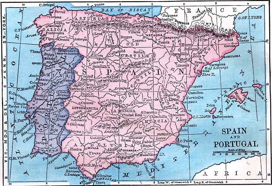
Description: A map of Spain and Portugal in 1872 at the time of the First Spanish Republic showing the country borders, provinces, major cities, towns, and ports.
Place Names: Iberian Peninsula, Portugal, �Spai
ISO Topic Categories: boundaries,
oceans,
location,
inlandWaters
Keywords: Spain and Portugal, physical, �political, physical features, country borders, boundaries,
oceans,
location,
inlandWaters, Unknown, 1872
Source: James Monteith, Comprehensive Geography (New York, NY: A. S. Barnes and Company, 1872) 66
Map Credit: Courtesy the private collection of Roy Winkelman |
|