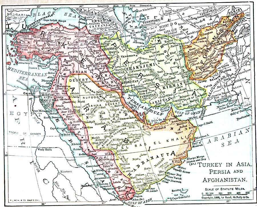
Description: A map from 1899 showing the extent of the Turkish Ottoman Empire from the Black Sea south to the western coast of the Persian Gulf and along the eastern coast of the Red Sea to the Gulf of Aden. The map also shows the Arabian Peninsula and the borders of Persia and Afghanistan at the time. The map shows major cities and ports, rivers, terrain, and British port possessions.
Place Names: Western Asia, Adana, �Ankara, �Hopa, �Icel, �Istanbul, �Izmir, �Konya, �Samsun, �Sivas, �Trabzo
ISO Topic Categories: oceans,
location,
inlandWaters
Keywords: Persia, Afghanistan, and Turkey in Asia , borders, �political, country borders, oceans,
location,
inlandWaters, Unknown, 1899
Source: George Edwin Rines, ed., The United Editors Perpetual Encyclopedia (New York, NY: United Editors Association, 1911)
Map Credit: Courtesy the private collection of Roy Winkelman |
|