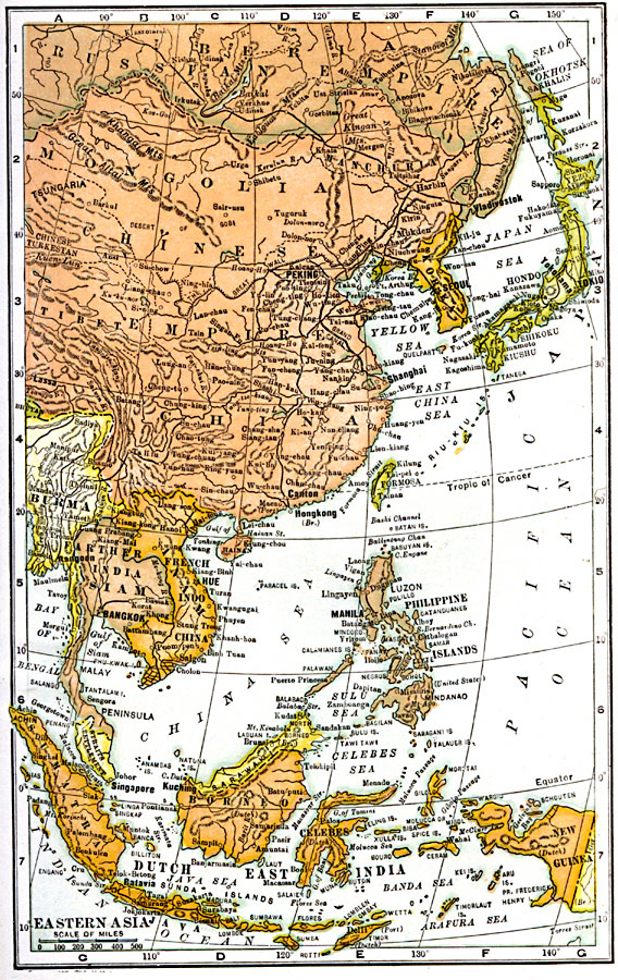
Description: A map from 1904 of East Asia showing the political boundaries of the time, including the Chinese Empire, Korea, the Empire of Japan, and the foreign possessions of Britain, France, Netherlands, and the United States. The map shows capitals and major cities, ports, railways, lakes, rivers, mountain systems and terrain, coastal features, and islands of the region.
Place Names: Eastern Asia, Borneo, �Burma, �China, �India, �Japan, �Mongolia, �Phillipines, �Russi
ISO Topic Categories: oceans,
location,
inlandWaters
Keywords: Eastern Asia, borders, �political, country borders, oceans,
location,
inlandWaters, Unknown, 1904
Source: George Edwin Rines, ed., The United Editors Perpetual Encyclopedia (New York, NY: United Editors Association, 1911)
Map Credit: Courtesy the private collection of Roy Winkelman |
|