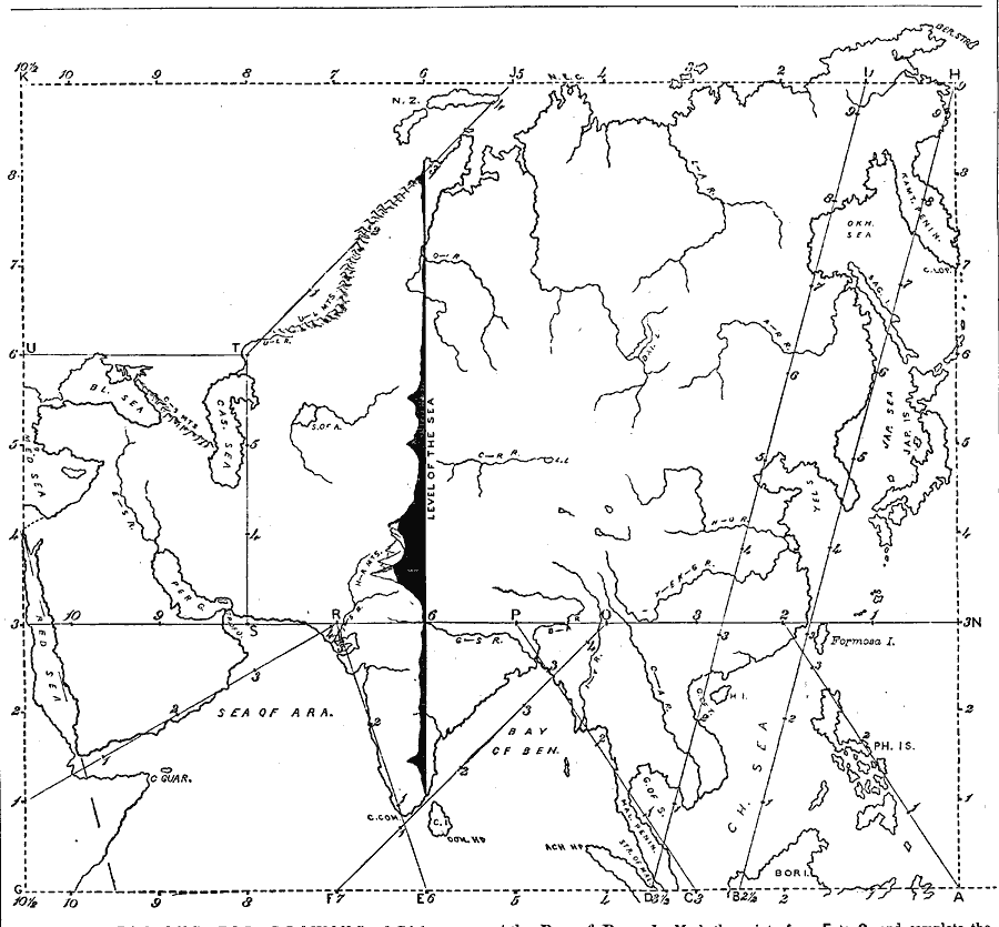
Description: A chart from 1872 illustrating instructions for drawing Asia. "General instructions for drawing the continents. Make a scale by marking on a slip of paper or pasteboard the measures 1,2,3, etc., as on the sides of this map. Every measure on the maps of the continents represents six hundred miles." By using this scale, the student should be able to establish the perimeter of the drawing, then using the scale and following the sequence of letters A, B, C, etc., recreate the guidelines needed to draw the outline of Asia. The chart includes a north–south cross-section of Asia showing the elevation profile.
Place Names: A Complete Map of Asia, Japan, �Phillipines, �Bay of Bengal, �Arabian Sea, �Cape Camarin, �Caucasus Mountains,
ISO Topic Categories: location,
inlandWaters
Keywords: Drawing Asia, physical, kMapSkills, physical features, location,
inlandWaters, Unknown, 1872
Source: James Monteith, Comprehensive Geography (New York, NY: A. S. Barnes and Company, 1872) 94
Map Credit: Courtesy the private collection of Roy Winkelman |
|