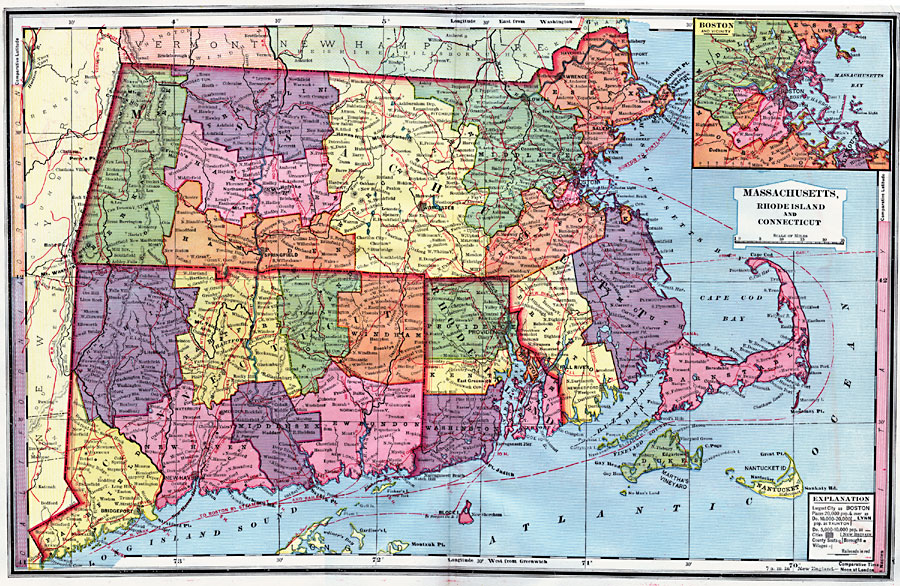
Description: Massachusetts, Rhode Island, and Connecticut with an insert of the Boston vicinity, showing physical features. Includes railroad and water routes.
Place Names: New England States, Boston, �Cape Cod, �Nantucket, �Salem, �Lowell, �Fall River, �Worchester, �Springfield, �Hartford, �Bridgeport, �New Haven, �Middletown, �New London, �Norwich, �Meriden, �Waterbury, �Providence, �Bristol, �Pawtucket, �Greenwich, �Narragansett Pier, �Ne
ISO Topic Categories: boundaries,
location,
inlandWaters,
oceans,
transportation
Keywords: Massachusetts, Rhode Island, and Connecticut, physical, �transportation, physical features, water routes,
railroads, boundaries,
location,
inlandWaters,
oceans,
transportation, Unknown, 1872
Source: James Monteith, Comprehensive Geography (New York, NY: A. S. Barnes and Company, 1872) s/16-17
Map Credit: Courtesy the private collection of Roy Winkelman |
|