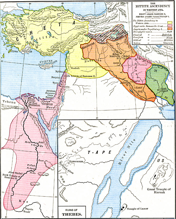
Description: A map of Asia Minor, Egypt, and Western Asia showing the Hittite Ascendancy and Egypt during the nineteenth dynasty. The map is color–coded to show the territory of the Hittites in Cheta (Anatolia) south to Syria west of the Euphrates River, Egypt and Palestine under Ramses II (Rameses the Great), Assyria under Tugultininep I (Tukulti–Ninurta I), Kossaea, Elam, and the territories of Na'iri and Urartu in eastern Anatolia. The map shows important historical cities of the time and rivers, using name forms (hieroglyphic, cuneiform, biblical, classical, and modern) where appropriate. An inset map details the portion of the Nile River near T–Ape (Thebes) showing the ruins of Rameseum, the Great Temple of Karnak, and the Temple of Luxor.
Place Names: Southwest Asia, Assyria, �Cheta, �Cyprus, �Elam, �Kas, �Kossae
ISO Topic Categories: oceans,
location,
inlandWaters,
boundaries
Keywords: The Hittite Ascendancy in Western Asia, borders, �historical, �political, major political subdivisions, historical event, oceans,
location,
inlandWaters,
boundaries, Unknown, about 1250 BC
Source: Robert H. Labberton, New Historical Atlas and General History (New York, NY: Townsend MacCoun, 1886) Plate IV
Map Credit: Courtesy the private collection of Roy Winkelman |
|