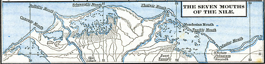
Description: A map of the seven mouths of the Nile as it was known in the Egyptian Twentieth Dynasty, when Zoan (Tanis) was the capital of northern Egypt. The delta mouths are the Canopic, Bolbitic, Sebennyitic, Phatnic, Mendesian, Tanitic, and Pelusiac. The sites of Pelusium (Chetam) and Sais are also shown.
Place Names: Egypt, Bolbitic, �Canopic, �Mendesian, �Nile River, �Pelusiac, �Phatnic, �Sebennytic, �Taniti
ISO Topic Categories: oceans,
location,
inlandWaters
Keywords: The Seven Mouths of the Nile, borders, �hydrological, kAncientEgypt, water routes, oceans,
location,
inlandWaters, Unknown, circa 1250 BC
Source: Robert H. Labberton, New Historical Atlas and General History (New York, NY: Townsend MacCoun, 1886) Plate IV
Map Credit: Courtesy the private collection of Roy Winkelman |
|