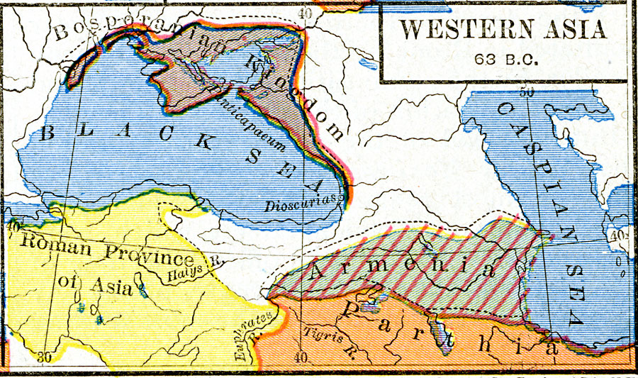
Description: A map of western Asia in the Pontus (Black Sea) region at the time of the death of Mithridates VI of Pontus at the end of the third Mithridatic War in 63 BC. The map is color–coded to show the territorial expansion of the victorious Romans, the reduced territory of the Bosporanian Kingdom, the extent of the Kingdom of Armenia under Tigranes the Great, and the northern frontier of Parthia.
Place Names: Southwest Asia, Armenia, �Bosporanian Kingdom, �Parthi
ISO Topic Categories: oceans,
location,
inlandWaters,
boundaries
Keywords: Western Asia, borders, �political, major political subdivisions, oceans,
location,
inlandWaters,
boundaries, Unknown, about 63 BC
Source: Robert H. Labberton, New Historical Atlas and General History (New York, NY: Townsend MacCoun, 1886) Plate XII
Map Credit: Courtesy the private collection of Roy Winkelman |
|