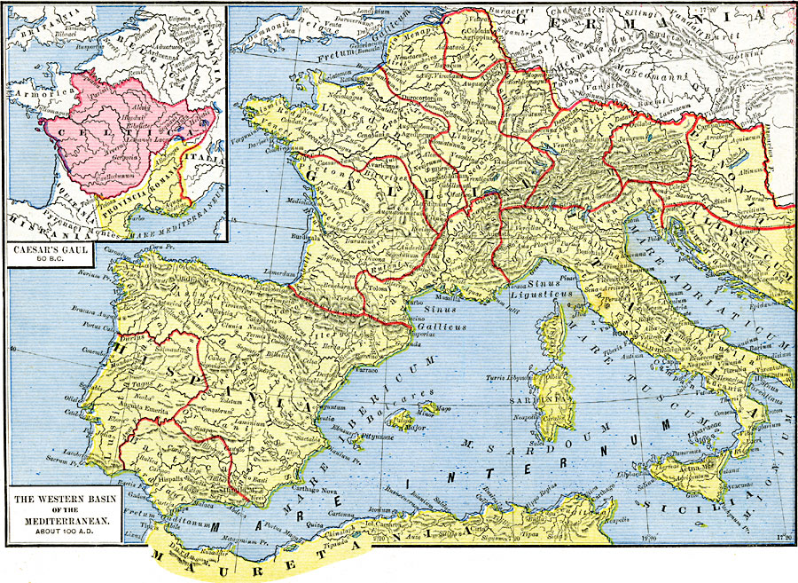
Description: A map of Europe and the western basin of the Mediterranean about AD 100 showing western Roman provinces, including Italia, the Hispania provinces of Baetica, Lusitania, and Tarraconensis, the Gallia provinces of Germania, Belgica, Lugdunensis, Aquitania, Narbonensis, Raetia, and Noricum, the province of Pannonia, and Illyricum. City names, place names, and the names of rivers, large bodies of water, and mountain systems are labeled in Latin. An inset map titled, "Caesar's Gaul 50 B.C." shows Provincia Romana and the territories of Celtica, Aquitania, Armorica, Britannia, Belgica, and Germania prior to full Roman control and division into Roman provinces.
Place Names: Western and Central Europe, France, �Italy, �Mauretania, �Sardinia, �Sicily, �Spain,
ISO Topic Categories: oceans,
location,
inlandWaters
Keywords: The Western Basin of the Mediterranean, borders, kRomanEmpire, oceans,
location,
inlandWaters, Unknown, Circa AD 100
Source: Robert H. Labberton, New Historical Atlas and General History (New York, NY: Townsend MacCoun, 1886) Plate XVII
Map Credit: Courtesy the private collection of Roy Winkelman |
|