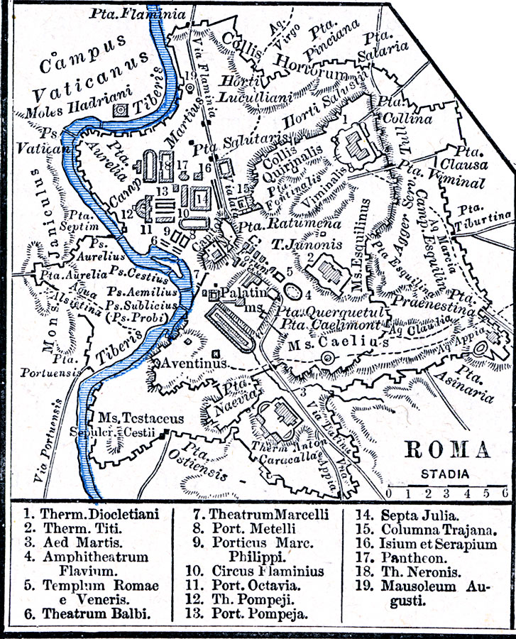
Description: A plan of Rome, Italy, circa AD 116, showing the River Tiber, the Seven Hills of Rome, city walls, major roads, bridges, aqueducts, and keyed references to the principle buildings of the city.
Place Names: Italy, Rom
ISO Topic Categories: oceans,
location,
inlandWaters
Keywords: Roma, borders, kAncientRome, oceans,
location,
inlandWaters, Unknown, AD 116
Source: Robert H. Labberton, New Historical Atlas and General History (New York, NY: Townsend MacCoun, 1886) Plate XIX
Map Credit: Courtesy the private collection of Roy Winkelman |
|