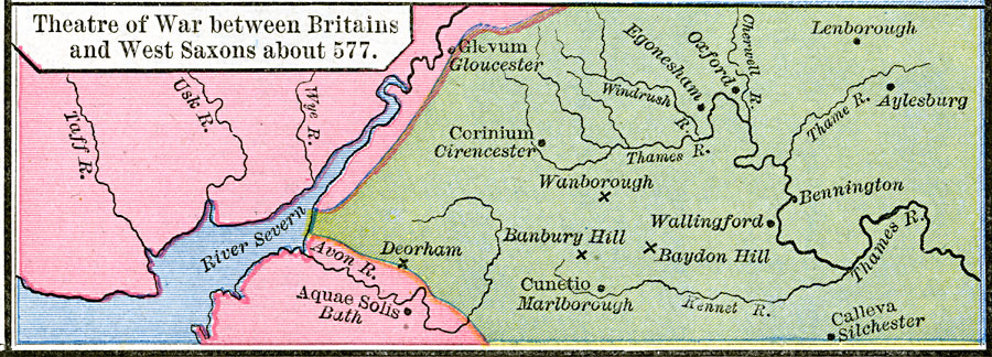
Description: A map of southwestern England and Wales from River Severn to Aylesburg on the Thames during the time of the West Saxon invasion into the territory of the Britains, around AD 577. The map is color–coded to show the territory of the Britains in pink, and the territory taken by the West Saxons in green. This map shows the cities with names of the period and their modern names, including Aquae Solis (Bath), Corinium (Cirencester), Glevum (Gloucester), Cunetio (Marlborough), and Calleva (Silchester). The map shows the battle sites of Deorham, Wanborough, Banbury Hill, and Baydon Hill.
Place Names: United Kingdom, Aylesburg, �Banbury Hill, �Gloucester, �Oxford, �Wallingfor
ISO Topic Categories: oceans,
location,
inlandWaters
Keywords: Theatre of War between Britains and West Saxons, borders, �historical, other military, oceans,
location,
inlandWaters, Unknown, AD 577
Source: Robert H. Labberton, New Historical Atlas and General History (New York, NY: Townsend MacCoun, 1886) Plate XXIV
Map Credit: Courtesy the private collection of Roy Winkelman |
|