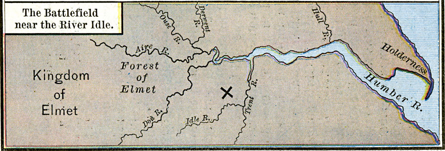
Description: A map of the area around the River Idle and Humber River in Nottinghamshire, England at the time of the battle between the East Angles under Raedwald and the Northumbrians under King &Aelig;thelfirth around AD 616–617. This map shows the battle site, and the Kingdom of Elmet, the Forest of Elmet, and the rivers Hull, Derwent, Ouse, Aire, Don, and Trent. &Aelig;thelfirth was killed in this battle, and his defeat resulted in the establishment of Edwin as king of Northumbria.
Place Names: United Kingdom, Elmet, �Holderness, �Idl
ISO Topic Categories: oceans,
location,
inlandWaters
Keywords: The Battlefield near the River Idle, borders, �historical, kBattle, other military, oceans,
location,
inlandWaters, Unknown, AD 616 – 617
Source: Robert H. Labberton, New Historical Atlas and General History (New York, NY: Townsend MacCoun, 1886) Plate XXV
Map Credit: Courtesy the private collection of Roy Winkelman |
|